


In the 1960s and 1970s, the Cuban waters were precisely surveyed and charted with Soviet aid and a hydrographic service was installed. Nautical charts in colour print, depths in meters and texts in English from ICH (Instituto Cubano de Hidrographia) enjoy an excellent reputation and should be preferred to the British and American charts, which are also available. A series of 26 charts (ca. 16 US$ each) in 1:150.000 scale covers the whole island, and there are detailed maps dowm to a scale of 1:5.000. This material is also published in the form of seven "Chart Kits" for pleasure craft, at a price of ca. 50 US$ each and available for example in Havana's Marina Hemingway or in Old Havana's Tienda „El Navegante“: La Habana-Vieja, Calle Mercaderes 115 between Obispo and Obra Pia, Tel. 0053-7- 613625).
There are two excellent Cruising Guides in English language, which complement each other very well by the information contained, so that both can be recommended alike. Both originate in circumnavigations of Cuba by their authors and have an according structure: "The Cruising Guide to Cuba" by Simon Charles has besides the nautical data a lot of general information related to the country, is written in a very sypathetic, personal style and thus also becomes a good general travel guide, its charts sketches are very compehensive, but "only" manually designed in black-and-white. Cartography is the strength of Nigel Calder’s "Cuba – A Cruising Guide", with two-colour charts based on own GPS-based surveys, and nautical information generally is far more detailed here. Both authors clearly indicate what is based on their own observations and what is "second hand" information.
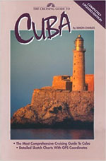 Simon Charles: The Cruising Guide to Cuba; 340 pages; 23x15 cm paperback; 2nd edition.1997; Cruising Guide Publications; Dunedin, Florida; ISBN 0-944428-36-6. $ 24,95 (ca. 31 EUR).
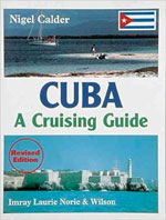 Nigel Calder: Cuba – A Cruising Guide; 260 pages; 28 x 21 cm paperback; 2nd edition 1999; Imray, Laurie, Norie & Wilson; St.Ives, England; ISBN 0-85-288-4133. £ 30,00 (ca. 53 EUR).
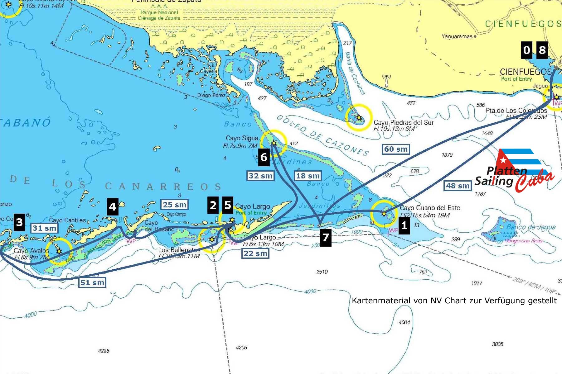
The majority of our guests decides for sailing to the coral cayos of the Canarreos archipelago. Cryistal-clear waters in all color shades of blue, turquoise and emerald, protected anchorages near fine white sand beaches and snorkeling and diving opportunities, which are unique in the whole world, are completed by the facilities of Cayo Largo Marina.
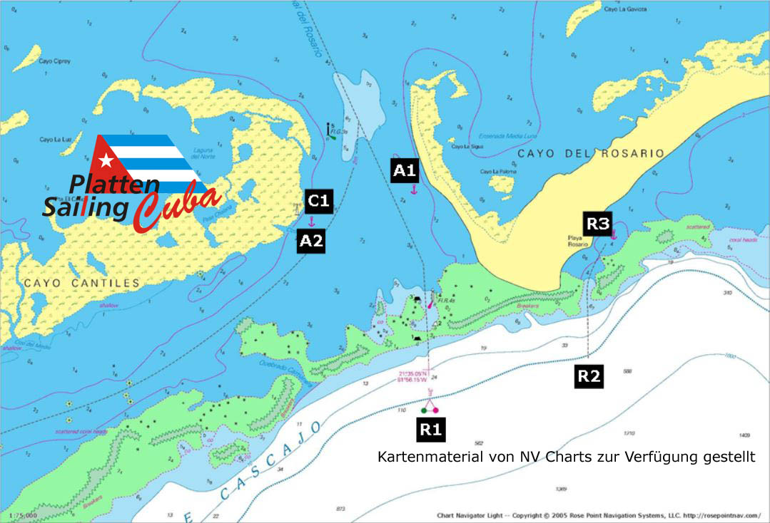
(Map of NV Chart - remarks by Platten Sailing Cuban S.A.)
Historic center (theater, cathedral, museums, shops), protected residential area Punta Gorda (Palacio de Valle), Marina with full supply, Marinashop
Environment: (Castillo de Jagua, Dolphinarium, Beaches, Botanical Gardens
Lighthouse, bathing beaches, breeding colony of Darting, snorkeling on the reef with great fish and lobster diversity
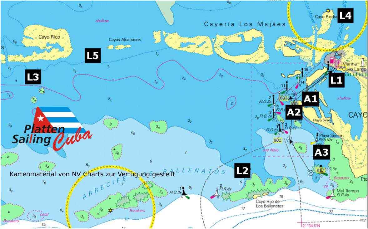
Fine sand white beaches, natural pools, very clear water. International tourism with shops, hotels, restaurants, nightlife, diving center, marina with water and diesel supply, marinashop, other shopping opportunities, various excursion destinations, see detailed map
Nature reserve, rich vegetation.
Animal watching, beach, snorkeling, fishing station, snorkeling on the reef with great fish and lobster wealth
Nature reserve with research station, monkey breeding station, mangroves, snorkelling on the reef with large fish and lobster wealth
east of it: Beautiful sandy beach on the south side of Cayo Rosario
Little sheltered anchorage on small rock group, beautiful coral reef for snorkeling, anchorage of fishermen, very clear water
Cayo Diego Pérez - Ernst Thälmann Island
Anchorage at Cayo Diego Pérez, then a detour to Ernst-Thälmann-Insel, the Fidel Castro 1972 symbolically gave the GDR.
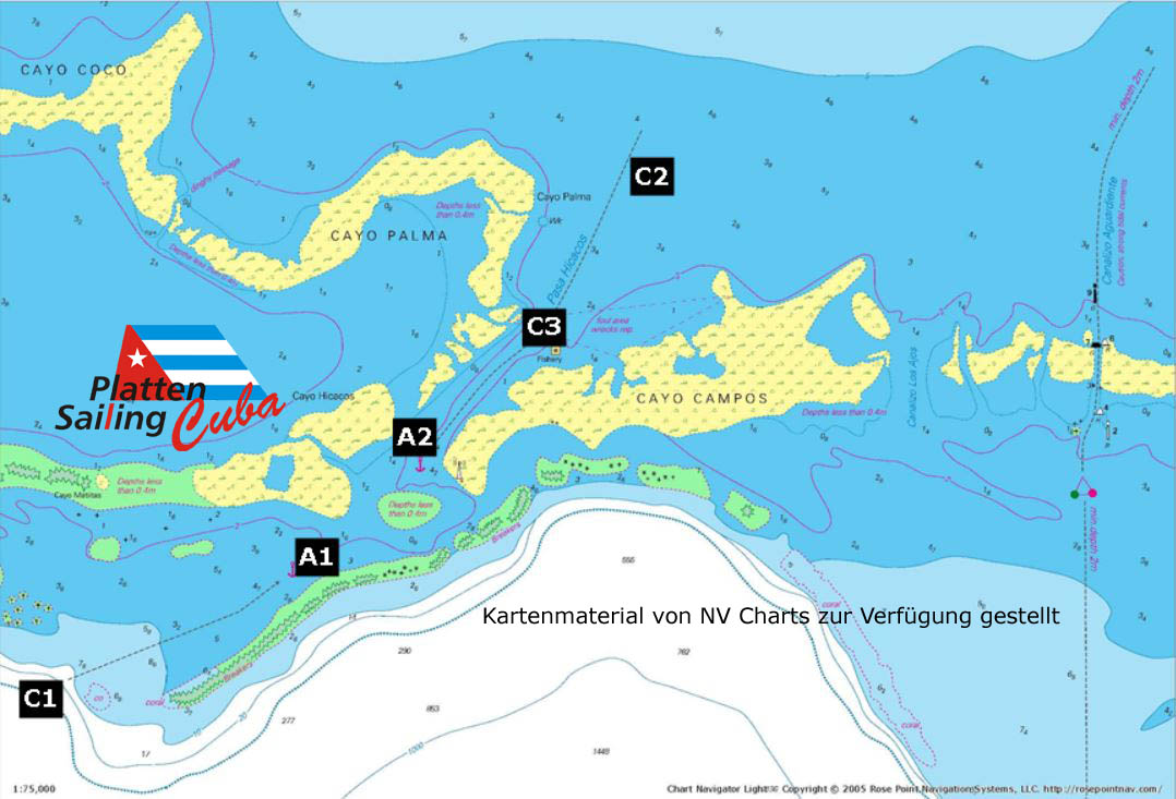
Especially beautiful, pine-lined beaches, watching free-living iguanas and birds.
Uninhabited island with lonely palm in the Center, coral reefs, beach, variety of birds, snorkelling on the reef with great fish and lobster wealth
Please, if desired, let us advise you at the boat takeover in Cienfuegos by our support staff in detail about currently possible destinations outside of the range described above.
Further information can be found in our dowload area.
Maps of NV Chart - remarks by Platten Sailing Cuban S.A.)
Marina also port of entry, marinashop, possibility to organize fresh produce, diesel, water (sometimes slightly salty) turtle breeding station, hotels, tourist shop, restaurants, hospital, medical care, open air diso, telphone and internet shop, dive center
Coral reef with a variety of fish, beautiful coral
Cayo Rico with a beautiful sandy beach, natural pools, day trip restaurant, wild iguanas
Mangroves and fine beach, free-living iguanas
Cayo Rico with a beautiful sandy beach, natural pools, day trip restaurant, wild iguanas
sheltered anchorage with wind from northeast to south, Marina and sandy beach of Playa Sirena accessible by dinghy, excursion restaurant and beach bar Playa Sirena accessible by dinghy
sheltered anchorage in light wind from the northeast, perfect white sand beach, excursion restaurant, beach bar
sheltered anchorage in light wind from northeast, perfect white sand beach with natural pools, lonely beach
Please, if desired, let us advise you at the boat takeover in Cienfuegos by our support staff in detail about currently possible destinations outside of the range described above.
Further information can be found in our dowload area.
(Map from NV Chart - remarks by Platten Sailing Cuban S.A.)
Beautiful white sand beach, natural pool, snorkeling on the fish-rich offshore reef
Good anchorage, safe in wind from north to southeast
Anchorage with protection from the west
Here you can participate in the morning animal feedings, and you can trade food or rum against fish, for example
Please, if desired, let us advise you at the boat takeover in Cienfuegos by our support staff in detail about currently possible destinations outside of the range described above.
Further information can be found in our dowload area.
(Maps from NV Chart - remarks by Platten Sailing Cuban S.A.)
Anchorage, safe in light wind from north to southeast, beautiful reef for snorkeling, lots of fish, very beautiful corals
Safe anchorage with wind from north to southeast, from there with the dinghy to the fishing station C3
Visit very interesting. You may be able to exchange food here, e.g. against fish
Please, if desired, let us advise you at the boat takeover in Cienfuegos by our support staff in detail about currently possible destinations outside of the range described above.
Further information can be found in our dowload area.